Extended Forecast
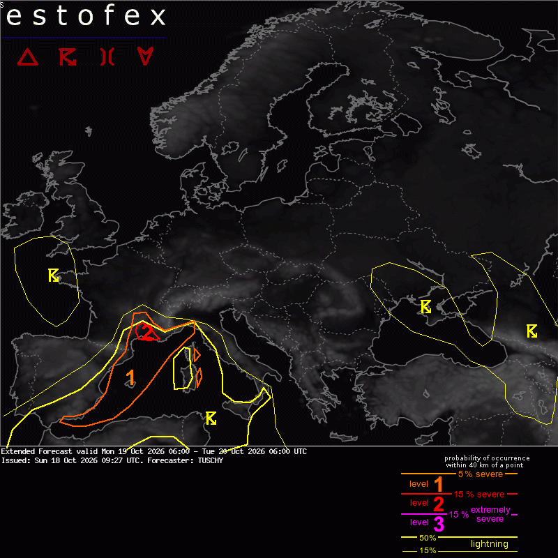
A level 2 was issued across S France (Cevennes and S) for excessive rain.
A level 1 surrounds the level 2 for heavy to locally excessive rain, including an isolated tornado risk along the coasts.
A level 1 was issued for the SE side of Corse and Sardegna mainly for locally heavy rain and an isolated tornado risk.
SYNOPSIS DISCUSSION
The disturbed pattern over Europe keeps going, as a blocking anticyclone evolves over Scandinavia. Various cut-offs along its S fringe affect most of S Europe, including the W/E Mediterranean.
A dominant vortex moves atop te Bay of Biscay, stalls there and turns back E during the end of this forecast ahead of a strong NE Atlantic trough. This vortex is connected to another upper low over Morocco, which weakens, opens-up and lifts NE towards the Gulf of Valencia until 06Z. This lifting wave induces a coupled upper jet configuration with improving divergence and falling MSLP atop the Gulf of Lion during the night. ISF-ENS recognizes that with a broad member imprint. Despite not much intensification of this LL vortex, this development decides, how focused any French heavy rain risk will evolve.
From the morning onwards, expect a broad sector with augmented severe from the Gulf of Valencia to the Balearic Islands to NE Spain (coasts) and SE Spain. The stalling zonal marine front from SWODY1 (near the Balearic Islands) lifts N during the day, which assists in a broadening moist and unstable warm sector with MUCAPE in the 1500 J/kg range and DLS around 15 m/s.
The most focused severe risk resides along mesoscale convergence zones, the marine front itself, ongoing clusters/MCVs - all features, which increase SRH/CAPE3 on a local scale. Hence the best is to point to a overall favorable setup for numerous slow moving multicell clusters/supercells with all kind of hazards, including excessive rain (weak SR anvil-layer flow/back-building), a few tornadoes, strong to severe gusts and isolated hail. This morning activity weakens until 12Z, but increases again during the afternoon onwards, as the BL vortex evolves. Dependant on the depression's evolution, even a regional MCS event cannot be ruled out with swaths of strong/severe gusts. However this scenario is still uncertain.
We kept this in a broad level 1 area, as many different scales interfer with lots of uncertainties regarding any focused severe. However, local events, worth a level 2, are possible.
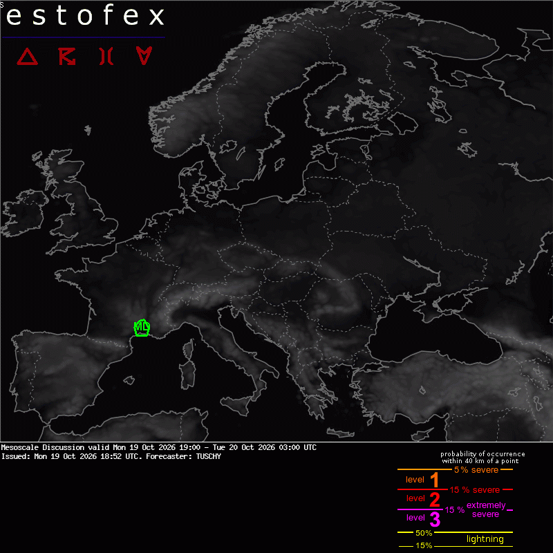
The shift of the steering vortex towards the Bay of Bisay takes it into te benchmark of a Cevennes/S France flash flood event, as lowering MSLP over W France induces a persistent moist/unstable SE-erly BL flow regime towards S France. Initial BL moisture recovery (from the synoptic-scale dried offshore flow before) should be completed betimes with moist/unstable onshore flow becoming firmly installed from noon onwards. Repeated onshore moving thunderstorms bring heavy to locally excessive rain, especially if any cell stalls along the orography or near the coastal convergence zone. Again, mesoscale dictates, if we get a V-shaped training MCS going for some time with the best background from the late afternoon onwards into the night. This riks subsides from the W, as the structuring vortex from the SW approaches and pushes a cold front slowly E along the S French coast. Latest indications are that this occurs just beyond 06Z however.
The main risk will be excessive rain with a few coastal tornado events.
We opted to not upgrade to a level 2 as this area is used to high rainfall amounts and the overall setup is not perfect for a stalled/focused MCS event, but this QPF imprint is rather broad, which could impact the flood risk similar to a more focused extreme stationary MCS event and hence a 2 was added.
We added more small level 1 areas for SE Sardegna, Corse and NW Italy to account for temporarily evolving back-building thunderstorms with heavy rain and an isolated tornado risk.